Gandikota road routes from Hyderabad: highway conditions
The road trip from Hyderabad to Gandikota covers approximately 360–400 km and normally requires 6–8 hours by car. The distance is manageable. The route is not uniformly easy.
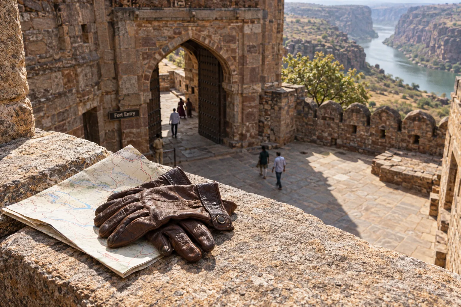
Most of the journey runs on broad, well-paved highways. The final 50–70 km changes operating conditions. Expect village bypasses, speed breakers, narrow sections, uneven surfaces, and slower traffic. The last approach is where poor timing and poor vehicle preparation become expensive.
The standard route runs from Hyderabad’s Outer Ring Road to NH 44 toward Kurnool, then onto NH 40, also known as the Rayalaseema Expressway. From the NH 40 corridor, the route continues toward Jammalamadugu and then Gandikota. Jammalamadugu is approximately 15 km from the canyon access area.
This is the practical basis for gandikota travel routes from hyderabad road conditions: fast highway travel first, low-speed rural driving at the end. Plan for both. Do not treat the entire route as a seamless four-lane expressway.
The primary highway corridor: NH 44 and NH 40
For most drivers, the most efficient road route to Gandikota canyon begins on Hyderabad’s ORR. From there, follow NH 44 toward Kurnool. The route then transitions to NH 40 toward the Panyam and Nandyal side of the Rayalaseema corridor before continuing in the direction of Jammalamadugu.
The major highway sections are generally the least difficult part of the drive. They are paved, multi-lane roads with better lane discipline, more predictable overtaking, and access to fuel and food stops compared with the final rural approach.
Route sequence
Use the following sequence as the base plan:
1. Exit Hyderabad through the Outer Ring Road.
Select the ORR connection that places you on the NH 44 corridor toward Kurnool. Urban traffic can change the departure time significantly, so the clock starts before the highway does.
2. Continue on NH 44 toward Kurnool.
This is a high-capacity, four-lane highway section. Traffic volume, toll plazas, and roadworks may affect average speed. Do not calculate arrival time from highway cruising speed alone.
3. Transition to NH 40.
NH 40 carries the route toward the Rayalaseema interior. The road remains substantially better than the rural sections encountered later.
4. Leave the main highway corridor for the Gandikota approach.
The final connection toward Jammalamadugu and Gandikota is slower. This is where route selection matters more than the headline distance shown by a navigation application.
5. Use Jammalamadugu as the final major orientation point.
Gandikota is approximately 15 km from Jammalamadugu. Once you leave the larger road network, reduce speed and expect irregular surfaces and local traffic.
On the major four-lane highways, typical cruising speeds may sit in the 100–120 km/h range when traffic and conditions allow. That figure is not a guaranteed travel speed and is not a reason to drive aggressively. It only describes the operating character of the highway sections. The final approach will reduce the average considerably.
The trip has two separate road systems: fast national highways and a slower rural access route. Pack, fuel, and schedule for the second one.
Why the map can mislead you
Navigation applications often display the Hyderabad–Gandikota journey as one continuous route. That presentation hides the operational difference between the road sections.
A route that looks direct may send you through a shorter rural connection with broken pavement, poorly marked turns, frequent speed breakers, and limited passing space. Another option may add distance but keep more of the journey on better-maintained roads.
For this drive, the shortest line on the map is not automatically the best road route to Gandikota canyon. The vehicle, weather, departure time, and passenger tolerance all affect the correct choice.
Check the route immediately before departure. The available mapping data may not reflect resurfacing, local diversions, temporary road damage, or a newly restricted turn. Exact conditions on state and rural roads can change after maintenance work or seasonal weather.
The final 50–70 km: where the drive slows down
The section after leaving NH 40 is the main variable in the Hyderabad to Gandikota driving directions. The last 50–70 km toward Jammalamadugu and Gandikota can include:
- Narrow rural roads with limited shoulder space.
- Potholes and patched surfaces.
- Uneven pavement at bridge approaches.
- Repeated speed breakers near settlements.
- Farm vehicles, motorcycles, pedestrians, and livestock.
- Poorly lit junctions after sunset.
- Sudden turns that are easy to miss at highway speed.
- Reduced overtaking opportunities.
- Sparse services compared with the NH 44 and NH 40 corridors.
The correct driving method is simple: reduce speed before the surface deteriorates, not after the suspension has already taken the impact.
Speed-breaker management
Speed breakers are a greater hazard than they appear. Some are painted. Some are not. Some have warning signs. Do not assume that a clear road ahead is a smooth road ahead.
Use the following approach:
1. Lift off the accelerator before village entries.
2. Scan the road surface for raised sections and darker repair patches.
3. Keep both hands on the steering wheel.
4. Cross damaged sections without sharp braking or steering inputs.
5. Leave additional space behind local traffic. A motorcycle or tractor may slow suddenly.
6. Avoid overtaking near bends, settlement entrances, and unmarked raised surfaces.
A low-clearance sedan can complete the journey, but it requires more attention on the rural section. A vehicle with stronger ground clearance provides more tolerance for potholes and uneven edges. That does not make high speed acceptable. Ground clearance reduces contact risk; it does not eliminate it.
Daylight is a logistics tool
Arriving at the rural approach during daylight provides three advantages:
- Road-surface defects are easier to identify.
- Unmarked turns and local junctions are easier to confirm.
- You have more time to resolve a navigation error before services become limited.
The 6–8 hour road estimate is a planning range, not a promise. Hyderabad departure traffic, toll stops, meal breaks, highway congestion, and the final rural approach all consume time. A late start can push the most difficult section into darkness.
For independent travelers carrying camping equipment, daylight arrival is more valuable than saving a small amount of highway time. It allows you to locate the accommodation or camping area, inspect the approach surface, and organize gear before visibility drops.
Jammalamadugu access: the last decision point
Jammalamadugu is approximately 15 km from Gandikota. Treat it as the final useful checkpoint rather than as proof that the difficult part is over.
At this stage, confirm three things:
- Your navigation pin is set to the correct destination, not merely to Gandikota town.
- You have enough fuel for the local movement and return connection.
- Passengers have secured loose equipment inside the vehicle.
The final 15 km may be short on paper. It can still consume time because of road width, surface damage, speed breakers, and local traffic. Do not apply the average speed from NH 44 to this section.
If you are carrying tents, coolers, camera cases, recovery equipment, or roof-mounted luggage, secure every item before leaving Jammalamadugu. Rural road vibration is persistent. A loose load can damage itself, shift vehicle balance, or become a hazard when the vehicle stops.
Do not rely on the final approach for supplies
The main highway corridor provides the better opportunity for planned fuel, food, and water stops. Services become less predictable as you move toward the canyon.
Before leaving the larger highway network, confirm:
- Fuel level sufficient for the complete local loop.
- Drinking water for every passenger.
- Food that does not require refrigeration or preparation.
- Charged phones and a vehicle charging cable.
- Offline route information or a saved map area.
- A basic puncture and tire-pressure plan.
- Cash for small local expenses where digital payment may not be reliable.
This is not excessive preparation. The final approach is not the place to discover that the vehicle has no spare tire, the cooler has leaked across the luggage, or the navigation application has lost the route.
The Duvvuru option: protecting the vehicle from rough bypasses
Travelers commonly recommend routing via Duvvuru rather than taking a direct bypass through rougher rural stretches. The purpose is not to create a scenic detour. It is to avoid unnecessary punishment to the vehicle and reduce exposure to the worst road sections.
The practical problem with direct rural shortcuts is inconsistency. A bypass can appear efficient because it removes several kilometers from the map. It may then introduce broken pavement, narrow lanes, repeated turns, and suspension impacts that erase any time saving.
Use Duvvuru as a route-planning option when the navigation application offers multiple connections between the NH 40 corridor and the Jammalamadugu side. Compare the following before committing:
| Route factor | Direct rural bypass | Route via Duvvuru |
|---|---|---|
| Map distance | May be shorter | May add distance |
| Surface consistency | Can be irregular and damaged | Often selected to avoid rougher patches |
| Vehicle stress | Higher when potholes and sharp edges are frequent | Potentially lower if the road surface is more consistent |
| Navigation workload | More local turns and junctions | Requires checking the correct Duvvuru connection |
| Night driving | Poor choice if road markings and lighting are limited | Still requires caution; daylight remains preferable |
| Best use | Only when current conditions are confirmed | Useful when protecting a low-clearance or heavily loaded vehicle |
Do not interpret this as a permanent road guarantee. Rural maintenance conditions change. The Duvvuru route should be treated as a strategic option, not a fixed rule. Check current navigation data and local reports before departure.
A route that protects the suspension is usually worth more than a nominally shorter route. Tires, wheels, and underbody components absorb the consequences of bad surfaces. A damaged tire near the canyon is not a minor inconvenience.
Vehicle preparation for the rural section
The minimum vehicle inspection should cover:
- Tire pressure, including the spare.
- Tread condition and visible sidewall damage.
- Jack, wheel brace, and locking-wheel-nut key.
- Engine oil and coolant warning indicators.
- Headlamps, brake lamps, and indicators.
- Windshield washer fluid.
- Phone mount and charging connection.
- Roof rack straps or external luggage tie-downs.
Do not load heavy equipment high on the vehicle unless the rack is rated for it and the load is secured correctly. Camping equipment should sit low and close to the vehicle centerline where possible. Keep emergency items accessible rather than buried beneath bags.
Gandikota route via Kurnool versus Kadapa
The Kurnool corridor is the clearest documented highway-based option from Hyderabad. It uses NH 44 and NH 40 before the final approach toward Jammalamadugu. For a driver starting in Hyderabad, this route has a straightforward logic: maximize the time spent on the larger highway network, then manage the rural section deliberately.
A route via Kadapa may appear attractive depending on the starting point, destination pin, and current map calculation. However, route comparison should not be based only on the displayed distance. Examine the road type for the final connection, not just the first half of the journey.
Use these decision rules:
- Starting in western or central Hyderabad: prioritize the NH 44 and NH 40 corridor unless current conditions show a clear problem.
- Carrying camping equipment: favor the route with more predictable pavement and fewer rough rural shortcuts.
- Driving a low-clearance sedan: avoid unverified direct bypasses.
- Driving after dark: choose the route with simpler navigation and reduce speed on all rural sections.
- Traveling during a high-traffic period: allow additional time before changing route solely to save distance.
- Using a heavily loaded vehicle: treat suspension and tire protection as primary route criteria.
The phrase “via Kurnool or Kadapa” is less useful than the actual road inventory. Count highway kilometers, rural kilometers, road width, and the number of unverified turns. A slightly longer highway route can be operationally easier than a shorter route that ends on damaged local roads.
The alternative scenic path: Kurnool to Banaganapalle
A second option runs through Kurnool toward Banaganapalle on State Highway 38, then continues on the Gandikota Road. This route is useful for travelers who want to combine the Gandikota trip with a broader interior Andhra Pradesh drive rather than simply minimize transit time.
The route sequence is:
1. Reach the Kurnool side through the main highway network.
2. Continue toward Banaganapalle using SH 38.
3. Proceed from Banaganapalle toward Gandikota.
4. Confirm the final destination pin and remaining fuel before entering the smaller-road section.
This path should not be assumed to be faster than the NH 40 and Jammalamadugu approach. Its value is route flexibility and the ability to build a wider itinerary. It also places more emphasis on state-highway and local-road conditions. Confirm current pavement and diversion information before committing.
For a dedicated one-day transfer from Hyderabad, the primary NH 44–NH 40 route is usually the more logical baseline. For a multi-stop road trip, the Banaganapalle option can make sense if the extra driving is part of the plan.
When the scenic route becomes inefficient
The Banaganapalle route is a poor choice when:
- You are already departing late.
- Your vehicle has a tire, cooling, or suspension concern.
- You need to reach a fixed check-in time.
- You are carrying a large roof load.
- You have not confirmed fuel and food stops.
- The route is being selected only because the map displays fewer kilometers.
- You will reach the smaller roads after dark.
A scenic label does not change road physics. More state-highway and rural kilometers mean more attention to surface quality, traffic behavior, and navigation.
Timing the Hyderabad to Gandikota drive
The stated Hyderabad to Gandikota travel time by car is approximately 6–8 hours. Use that as the base window, then add margin for the actual departure conditions.
A workable timing model separates the journey into three parts:
| Travel segment | Operating character | Planning concern |
|---|---|---|
| Hyderabad to NH 44 | Urban and ORR traffic | Departure congestion can delay the entire trip |
| NH 44 to NH 40 | Fast, paved, multi-lane highway | Toll plazas, traffic, and planned stops affect the average |
| NH 40 exit to Gandikota | Rural, narrower, uneven in places | Surface defects, junctions, speed breakers, and darkness |
Do not schedule the destination arrival by multiplying the total distance by a highway speed. That calculation ignores the final 50–70 km and produces a false sense of control.
Toll and payment planning
Approximate round-trip toll costs are commonly reported in the range of ₹400–₹600, but toll tariffs can change. Treat this as a budgeting range, not a fixed fare.
Keep the following available:
- A working FASTag account with sufficient balance.
- A backup payment method.
- Some cash for small purchases and local contingencies.
- A record of the vehicle registration details if needed for toll or roadside assistance issues.
Toll preparation is minor compared with the overall trip, but an insufficient FASTag balance can create an avoidable delay at the start or end of the drive.
Fuel strategy
Refuel on the larger highway corridor rather than waiting for the final approach. The decision should be based on tank range, not optimism.
A vehicle that begins the rural section with a low fuel level creates three problems:
1. The driver may need to detour from the planned route.
2. Navigation decisions become constrained by the search for a station.
3. The return journey becomes dependent on finding fuel at the expected location and time.
For camping trips, add the energy demand created by extra local driving between the accommodation, fort area, canyon viewpoints, and other activity points. The route to Gandikota is not necessarily the complete vehicle movement for the day.
Driving procedure for a loaded road-trip vehicle
A Gandikota trip often involves more equipment than a normal hotel transfer. Tents, sleeping systems, cooking items, water containers, lighting, camera equipment, and protective clothing increase vehicle mass and reduce available luggage space.
Before starting the engine, inspect the load:
- Heavy items low and forward.
- Fragile items isolated from hard metal equipment.
- Water containers upright and sealed.
- No loose objects on the parcel shelf.
- Roof load compressed and tied at multiple points.
- Emergency kit reachable without unloading the vehicle.
- Rear visibility maintained through the mirrors.
- Doors and hatch fully latched.
On NH 44 and NH 40, the loaded vehicle may feel stable and fast. That stability can disappear on the rural section when the surface becomes uneven. Reduce speed before pothole fields and avoid abrupt lane changes around damaged pavement.
If a tire loses pressure, stop in the safest available location. Do not continue at highway speed on a visibly damaged tire. A slow puncture may become sidewall destruction after several kilometers of heat and load.
If the vehicle develops a cooling warning, brake issue, steering vibration, or repeated underbody impact, stop and diagnose the problem. The correct response is not to reach Gandikota first and inspect the vehicle later.
A road trip failure usually starts as a small logistics omission: low fuel, unsecured luggage, a weak spare tire, or a late departure.
Navigation errors that cost time
The route contains several points where a navigation application can give a technically valid but operationally poor instruction. The application may prioritize distance or estimated time without understanding the condition of a specific rural road.
Use navigation as a tool, not as a substitute for route judgment.
Confirm the destination pin
Gandikota can refer to a wider local area. Accommodation, the fort complex, canyon viewpoints, and camping locations may not share the same access point. Save the exact destination before entering the final approach.
Do not wait until the vehicle is on a narrow road with weak connectivity. Download or save the route information while you still have reliable service.
Watch for route recalculation
If the driver misses a turn, the application may redirect through a smaller road. That route may be shorter but less suitable for a loaded car. Stop safely and review the alternative before accepting an automatic recalculation.
A five-minute review at a safe roadside location is preferable to committing to an unverified rural shortcut.
Use fixed landmarks
The practical landmarks are the major road transitions and the Jammalamadugu area:
- Hyderabad ORR.
- NH 44 toward Kurnool.
- NH 40 toward the Rayalaseema corridor.
- The selected exit toward Jammalamadugu.
- Jammalamadugu.
- The final Gandikota access road.
If the application begins showing a sequence of narrow local turns before the planned transition, check whether it has moved you away from the intended corridor.
Road-trip safety at the canyon approach
The canyon destination does not remove ordinary road hazards. It adds edge exposure, uneven ground, heat, limited shade, and the possibility of walking away from the vehicle.
For the drive itself, the minimum road-trip safety standard is:
- Travel the rural section in daylight when possible.
- Reduce speed at every settlement and blind bend.
- Do not overtake where the road narrows or the shoulder disappears.
- Keep water accessible inside the passenger compartment.
- Stop only where the vehicle is fully clear of the traffic path.
- Do not leave valuables visible during stops.
- Check tire pressure before the return journey.
- Keep a charged phone and a second communication option if available.
- Do not assume that mobile service will be continuous at the canyon edge.
- Tell another person your planned route and expected arrival window.
The final road can be physically short and still be the highest-risk portion of the trip. Narrow pavement, poor lighting, unfamiliar turns, and fatigue combine badly.
Heat and fatigue management
A 6–8 hour drive from Hyderabad is long enough for fatigue to affect judgment, especially if the driver leaves after work or begins with urban congestion. The solution is not stronger coffee. It is an earlier departure, planned stops, and a second licensed driver where available.
Keep water in the cabin, not only in the luggage compartment. Store basic food where it can be reached without stopping on an unsafe shoulder. Use the larger highway stops for meaningful breaks and reserve the rural section for controlled transit.
If the driver is drowsy, stop. The final 15 km will not become safer because the destination is close.
Final departure protocol
Use this sequence before leaving Hyderabad:
1. Confirm the route corridor.
Verify the NH 44 to NH 40 plan and identify the selected rural connection.
2. Check the last approach.
Review the current route to Jammalamadugu and Gandikota. Look for warnings, closures, and unexpected local-road diversions.
3. Set the exact destination.
Use the accommodation, campsite, or fort access point rather than a broad town label.
4. Fill the tank on the highway network.
Do not defer all refueling until after leaving NH 40.
5. Inspect tires and luggage.
Include the spare tire and all external straps.
6. Load water and food inside the cabin.
Keep essential items reachable during the rural approach.
7. Plan a daylight arrival.
The final 50–70 km deserves visibility and lower pressure.
8. Keep a route alternative.
Duvvuru may be preferable to a rough direct bypass. Banaganapalle via SH 38 is a separate option for a wider itinerary.
9. Budget for toll variation.
A reported round-trip range of ₹400–₹600 is only an approximation.
10. Set the return plan before arrival.
Confirm fuel, departure time, vehicle condition, and the road connection back to the main highway.
The best gandikota travel routes from hyderabad road conditions are not defined by one perfect line on a map. They are defined by how much of the journey remains on reliable highways, how deliberately the final rural section is driven, and whether the vehicle arrives with its tires, suspension, and occupants intact.
Use NH 44 and NH 40 as the primary highway corridor. Treat the final 50–70 km as a separate route problem. Consider Duvvuru when it avoids rough bypasses. Use the Banaganapalle road when it fits a wider itinerary, not when it merely looks shorter. Leave with fuel, daylight, secured equipment, and a destination pin that is actually correct.
That is the route plan. The rest is disciplined driving.