Pennar river kayaking routes: choosing your canyon path
Kayaking the Pennar River at Gandikota is not a roadside paddle. The launch point sits below the canyon rim, and reaching it means hauling your boat and kit down roughly 30 minutes of steep, rocky boulder terrain. The return climb is the harder half.
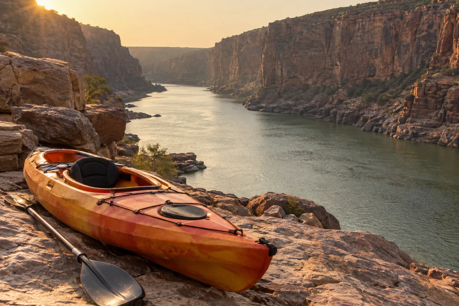
Treat that approach as part of the route, not as an inconvenience before the real activity begins.
The river runs through a gorge cut into the Erramala Hills, with canyon walls reaching approximately 300 feet above the Pennar. That scale changes everything: access, communication, rescue time, water conditions, and the amount of gear you can safely carry. The best kayaking routes on Pennar River Gandikota are not selected from a neat map of named runs. They are chosen on the day by reading the water, checking dam-related flow conditions, and matching the paddle to your group’s strength.
The route starts at the canyon rim. If you cannot descend, paddle, and climb out with control, you do not have a viable kayaking plan.
Read the canyon before you choose the river
Gandikota gives you a dramatic launch environment, but drama does not equal technical white water. The available factual record does not establish official rapid classifications or named sub-routes along the Pennar stretch at the canyon. Do not arrive expecting a certified Class III or advanced white-water run simply because the gorge looks severe from above.
Your first job is to separate the visual scale of the canyon from the actual demands of the river.
The Pennar cuts through a confined landscape, but the paddling experience will depend heavily on current, recent rainfall, local obstructions, water releases, and the operating conditions around Mylavaram Dam. A narrow-looking section may carry manageable water one day and become unsuitable after a change in flow. A broad, quiet reach may still create problems if your group lacks the strength to maneuver or if the exit requires a steep haul over loose rock.
Think in terms of three route questions:
1. Can you reach the launch area without losing control of the equipment?
The descent involves boulders and uneven ground. You need secure footwear, free hands where possible, and a system for moving boats and dry bags without dropping them onto people below.
2. Can you paddle the available water and still return with reserve?
Do not use all your strength on the outward section. The canyon exit demands energy, especially when you are carrying wet equipment uphill.
3. Can you leave the river if the conditions deteriorate?
A route is not acceptable merely because the launch is possible. Confirm where the group can regroup, turn around, or move out before committing to a longer paddle.
This is why the best kayaking spots in Gandikota Canyon are condition-dependent rather than fixed points on a universal beginner map. Local operators may combine kayaking with canyon camping, rappelling, rock climbing, or other outdoor activities, but a package itinerary does not remove the need for a water assessment.
The descent is a technical section of the route
The approximately 30-minute downhill hike from the top of the gorge near Gandikota Fort can look simple when you view it from a distance. It is not a flat walk. Expect steep, rocky ground and large boulders that force you to place each foot deliberately.
Do not carry a kayak downhill as if you are moving luggage through an airport. Control it. Keep it balanced. Protect the hull from unnecessary impacts. Maintain spacing between people so a slipping load does not take out the person below.
Move the group in the right order
Before leaving the rim, secure loose straps, paddles, bags, and personal items. Anything that can swing, roll, or catch on rock will become a problem on the descent. If an operator supplies boats or equipment, ask how the gear will be divided and who controls the load movement.
Use a simple sequence:
- Send the route leader first. The lead person identifies stable footing, loose stones, narrow passages, and places where the group must pass one at a time.
- Move people before awkward loads. If the terrain is exposed or crowded, establish the safest position for each person before lowering a boat or heavy bag.
- Keep three points of contact. Grip rock, plant both feet, and move only when your next hold or step is secure.
- Lower equipment rather than dragging it. Dragging a kayak across sharp rock can damage the hull and destabilize the person handling it.
- Stop at natural regrouping points. Do not let the strongest hikers disappear ahead while less experienced members negotiate the descent alone.
- Protect the return route. Notice landmarks on the way down. The climb back may happen in heat, low light, or after fatigue has reduced your attention.
Wear footwear with a firm sole and reliable grip. Flip-flops have no place on this approach. A shoe that slips on loose stone can turn a short access hike into the day’s primary incident.
The descent also exposes a planning mistake: overpacking. Carry only what the group can move safely. Extra clothing, bulky coolers, uncontrolled hard cases, and unnecessary camping equipment make the approach slower and increase the chance of a fall. If your plan combines paddling with canyon camping, divide loads carefully and decide in advance what must reach the river and what can remain at the top.
Treat the return as a separate challenge
Many groups assess the downhill walk and forget the climb out. That is backwards. Descending uses gravity. Climbing back requires traction, leg drive, breathing control, and enough reserve to handle the same broken terrain while carrying wet equipment.
Before launching, identify the turnaround time that leaves room for the exit. Do not extend the paddle simply because the river feels calm. A late return can force rushed movement on unstable ground. That is where avoidable mistakes happen: a missed foothold, a dropped load, a strained knee, or a group split across the slope.
Water levels decide whether the route is open
Kayaking on the Pennar is seasonal. Water conditions can change with rainfall and dam operations, including releases associated with the nearby Mylavaram Dam. You cannot treat a previous visitor’s photos or a fixed itinerary as proof that the same route will be suitable on your date.
Check the Pennar River water levels for kayaking before you travel, and confirm the current situation again with the local operator or guide close to launch time. Ask direct questions. Avoid vague assurances such as the river being fine or the activity running as usual.
Ask:
- What are the current water and flow conditions at the launch area?
- Have dam operations or recent rainfall changed the river level?
- Is the planned section suitable for the least experienced paddler in the group?
- Where is the turnaround point?
- What happens if the operator cancels after the descent?
- How will the group exit if the river becomes unsuitable during the paddle?
- Which safety equipment will be provided, and what must you bring?
Do not assume a higher water level automatically means better kayaking. More water can alter current speed, conceal rocks, change eddies, and make a familiar section behave differently. Lower water can expose obstacles, scrape hulls, and create awkward channels. The correct level is the level that matches the route, the craft, the group, and the supervision available.
Watch for changes, not just a single reading
A single water-level update is not enough if conditions are shifting. Ask whether the river has been rising, falling, or holding steady. A stable level gives the operator a clearer basis for planning than a rapidly changing one.
Weather matters even when rain is not falling directly above you. Runoff upstream can affect the river later. Dam discharge can also change the character of the water without warning to a visitor standing on the canyon rim. Stay with the guide’s instructions, keep the group together, and do not paddle beyond the agreed section.
On the Pennar, water level is not a background detail. It is the route selector.
Choose the route by paddler, not by scenery
A strong-looking itinerary can still be wrong for a beginner. The canyon walls may attract experienced climbers and trekkers, but kayaking demands its own habits: balance, paddle control, communication, and the ability to respond calmly when the boat turns or drifts.
For beginner kayaking trails in Gandikota, favor the most controlled section available under current conditions. That usually means a route with clear instruction, manageable current, straightforward regrouping points, and a conservative turnaround plan. Do not judge suitability by distance alone. A short paddle in awkward flow can demand more control than a longer, calmer section.
Use this practical comparison when discussing the plan with an operator:
| Route factor | More suitable for beginners | More demanding for the group |
|---|---|---|
| Current | Slow or predictable movement with room to correct | Fast, changing, or difficult-to-read flow |
| Shoreline | Clear regrouping areas and practical exit options | Steep banks, unstable boulders, or limited access |
| Distance | Short enough to preserve energy for the climb out | Long enough to leave the group fatigued |
| Supervision | Guide close enough to give immediate instruction | Minimal supervision or a widely spread group |
| Water level | Stable and matched to the craft | Recently changed or affected by uncertain discharge |
| Equipment | Properly fitted flotation and suitable boats | Mixed equipment with poor fit or no clear rescue plan |
| Group ability | Everyone can follow commands and paddle steadily | Wide gap between strongest and least experienced members |
A beginner should not be placed at the back of a fast-moving group and told to follow the others. The guide needs to see the least confident paddler, not just the strongest boat. Keep the formation compact enough for communication without creating collisions.
If you already paddle regularly, resist the urge to turn a guided canyon outing into an improvised skills test. Remote terrain changes the consequences of small errors. Practice edging, turning, stopping, and re-entering the boat in appropriate training conditions rather than using a canyon excursion as your first serious session.
Equipment: carry less, fit everything properly
Gandikota water sports equipment rental may be available through activity operators, but exact standalone pricing and equipment lists are not fixed in the available information. Confirm what the package includes before you commit. The phrase equipment provided can mean a complete paddling setup, or it can mean only the boat.
Clarify whether the operator supplies:
- Kayak and paddle suited to the planned river section
- Properly fitted personal flotation device
- Helmet where the route or operator’s risk assessment requires one
- Dry bags or waterproof protection for essential items
- Throw line or other rescue equipment
- First-aid supplies
- Communication equipment
- Transport or assistance for moving equipment down to the launch
- Guide support during the descent, paddle, and climb out
Fit the flotation device tightly enough that it does not ride up when you enter the water. Check every buckle before leaving the rim. Keep essential items secured rather than loose in cockpit space or open bags. A phone that is technically waterproof is not useful if it disappears beneath a moving boat.
Carry water and protect it from being lost on the descent. Heat, rock scrambling, and paddling combine quickly. Do not wait until you feel dehydrated before drinking. Pack food only if you can secure it and carry the waste back out. The canyon is not a place to scatter wrappers, plastic, or damaged gear.
Your clothing should handle both wet conditions and sharp rock. Avoid loose accessories that can catch on equipment. Secure glasses. Tie back anything that can obstruct vision or snag during a capsize response.
Build kayaking into the wider Gandikota plan
Kayaking is often organized alongside canyon camping, rock climbing, rappelling, and visits to Belum Caves. That combination can create a strong multi-day itinerary, but it can also stack fatigue too aggressively.
Do not schedule the most physically demanding activities back-to-back without recovery time. A morning paddle followed by a long rappelling session may leave your grip and legs depleted. A canyon hike before kayaking may reduce your ability to control the boat. If your trip includes camping, count the equipment haul as part of the physical workload.
A sensible sequence depends on conditions and operator logistics, but your planning should account for:
1. Access effort: the descent to the Pennar launch area and the climb back.
2. Paddling demand: time on the water, current, wind exposure, and the need to maneuver.
3. Additional vertical activity: rappelling, climbing, or scrambling on the same day.
4. Heat and recovery: water, shade, food, and enough time to rest.
5. Light levels: no late push onto the boulder descent unless the operator has specifically planned and equipped for it.
6. Transport between sites: Gandikota is roughly 15 kilometers from Jammalamadugu and approximately 77 to 80 kilometers from Kadapa, so transfers can add time and fatigue.
Keep the itinerary flexible. If water conditions cancel the paddle, do not replace it automatically with another high-risk activity while the group is already tired. A safe trip is not measured by how many activities you force into one day.
Safety protocols for remote canyon paddling
Follow the operator’s briefing even if you have paddled elsewhere. The Pennar canyon has its own access constraints, and the launch environment may be unfamiliar. Ask where to assemble, where to leave nonessential gear, how the group communicates, and what signal means stop.
Before launching, confirm these points with the entire group:
- Everyone knows the planned direction and turnaround point.
- Everyone understands the guide’s commands.
- Every paddler wears a correctly fitted flotation device.
- The group has a method for handling a capsize.
- The guide knows who is least experienced or least confident.
- No one leaves the agreed river section alone.
- The exit route remains realistic for the group’s current energy level.
- Weather, water level, and dam-related conditions remain acceptable.
If you capsize, follow instruction rather than improvising. Keep hold of the paddle if you can do so without creating a hazard. Stay with the boat unless the guide directs otherwise. Move away from rocks and other boats. Do not attempt a dramatic solo swim toward shore unless the current and guide make that the safest option.
Use your voice. Canyon walls can make communication difficult, and a group that spreads out quickly loses control of the situation. Call early when you need help. Do not hide fatigue, fear, dizziness, or a damaged boat because you do not want to delay the itinerary.
Go or no-go: make the decision before the launch
Go when:
- The operator has confirmed current conditions for that day.
- The water level and flow match the planned section.
- Every participant can manage the descent and the climb out.
- The equipment fits and the flotation devices are secure.
- The group understands the route, signals, turnaround, and exit plan.
- You have enough daylight and energy in reserve.
- The least experienced paddler can realistically complete the outing.
Call it off when:
- The operator cannot explain the current water or dam-related conditions.
- The river has changed rapidly and no one can confirm a safe section.
- A participant cannot descend or climb out safely.
- Equipment is missing, damaged, or poorly fitted.
- The group has no clear rescue or communication plan.
- Heat, illness, injury, or fatigue has already reduced control.
- The schedule depends on rushing the boulder descent.
- Anyone feels pressured to continue after raising a safety concern.
That final point matters. A guide can manage a route. A guide cannot override physics, water flow, poor equipment, or an exhausted group.
The right Pennar route is the one you can exit
Choose kayaking routes on Pennar River Gandikota by combining three realities: the river’s current condition, the physical access route, and your group’s ability to return safely. The canyon is approximately 300 feet deep, and the launch requires a real downhill boulder descent. Those facts should shape the day before anyone touches a paddle.
Start with the water report. Confirm dam and flow conditions. Match the section to the weakest paddler. Move equipment carefully. Keep reserve strength for the climb. Build the rest of the Gandikota itinerary around the paddle instead of treating kayaking as a quick add-on between other adventures.
If the water is stable, the equipment is sound, the group is prepared, and the exit plan remains clear, launch. If any of those pieces fail, stay on the rim and choose a safer activity. The canyon will still be there. A responsible paddler does not chase a route that the conditions have already rejected.