Pennar river water levels: safe conditions for canyon kayaking
Here’s the blunt reality most first-timers miss: the Pennar River inside the Gandikota canyon is not a free-flowing mountain stream. It is a reservoir-controlled corridor, dammed upstream by Gandikota Reservoir and held downstream by Mylavaram Dam.
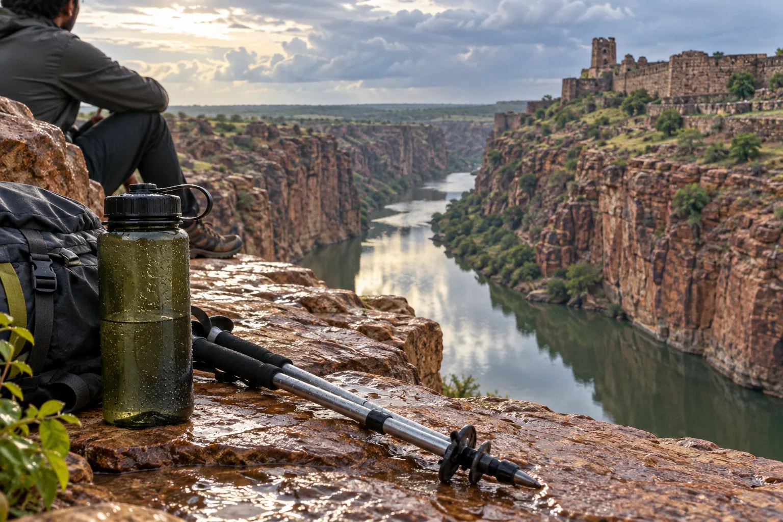
The water you paddle through behaves more like a slow backwater than a whitewater run, and that distinction dictates every safety decision you make before stepping into a kayak.
Treat it like rapids and you will misread the conditions. Treat it like a lake and you may ignore the depth changes, exposed shelves, and operational uncertainty that become more important during dry months. The key question is not simply whether there is water in the gorge. It is whether the level, current, access route, weather, and return plan all make that particular day suitable for paddling.
The canyon walls rise roughly 300 feet of red granite above the riverbed, which makes the gorge feel wild and remote. The water itself, however, is managed. Operators and independent paddlers who understand this managed-hydrology reality arrive with the right expectations and leave without turning the trip into a rescue exercise. Those who do not may find themselves dragging boats across shallow gravel bars because they arrived in the wrong season or launched without checking the day’s conditions.
Get the water-level picture straight first. Then plan the hike, the launch, and the return around it.
The Mechanics of Reservoir-Controlled Flow in the Gorge
You have not got a snowmelt-fed river on your hands. You have two dams bracketing the canyon and a reservoir system doing much of the regulating. Gandikota Reservoir has a total storage capacity of 26.85 TMC, fed by local Penna rainfall and supplemented by Krishna River water transferred through the Srisailam-Gorakallu-Owk corridor. Mylavaram Dam sits downstream, impounding the river and holding the gorge section as a stable backwater pool for much of the year.
That setup explains why the Pennar can look deceptively quiet. The gorge has the visual drama of a river canyon, but the paddling environment is usually closer to flat water. The absence of obvious rapids does not mean that conditions are fixed. Reservoir levels, irrigation demand, rainfall, evaporation, and dam operations all affect the amount of water available in the navigable section.
What this means on the paddle:
- The flow is generally calm, ranging from still water to a mild drift rather than a technical whitewater current.
- Water depth changes according to seasonal and operational patterns, not only according to the rainfall you can see on the day.
- Releases from Mylavaram Dam can alter the downstream current. Ask local operators about the release status before launching, and stay off the water if a release is expected during your paddle.
- The riverbed is not uniform. Sandbars, submerged rocks, and shallow shelves become more exposed during low-water months, especially near inside bends where sediment collects.
- A calm surface does not tell you the depth below it. The gorge can look perfectly paddleable while the channel has narrowed around gravel bars or shelves.
The important distinction is between current speed and water level. A river can have a gentle surface current and still be difficult to navigate if there is not enough depth for the boat. Conversely, a higher level may make shallow sections easier to cross while introducing more drift and less forgiving consequences near the banks.
Treat the section as a flat-water paddle with canyon atmosphere, not as a river-running descent. That single shift in mindset changes how you rig the boat, how you read the surface, and how seriously you take the return journey.
The Pennar is calm enough for a relaxed paddle, but its calm surface does not remove the need to check depth, releases, and the route out.
Seasonal Water Dynamics and Depth Expectations
The Pennar inside the canyon can become markedly shallower during dry or low-rainfall periods. The change is easy to underestimate because it often happens gradually. There may be plenty of water at the launch point while another bend has become awkward for a loaded kayak. A route that looked straightforward earlier in the season can turn into a sequence of shallow crossings, gravel bars, and boat-dragging sections.
A depth that works comfortably at the put-in does not describe the entire route. Sediment moves. The channel is rarely the same width from one bend to the next. A boat may float easily through the central section and then scrape bottom near a shallow shelf. In a sit-on-top kayak, you may be able to step out and pull the boat through. In a loaded sit-in kayak, the same stretch can turn into an awkward exercise in balancing, lifting, and protecting the hull.
The calendar typically plays out like this:
| Period | Expected conditions | Operational note |
|---|---|---|
| November–February | Cooler weather, relatively stable reservoir levels, and comfortable conditions for a longer paddle | Often the most practical window, with fewer monsoon-related disruptions and more manageable temperatures |
| March–May | Rising heat and gradual drawdown as evaporation and irrigation demand affect available water | Shallow shelves and exposed gravel bars become more significant; ask about the current state of the route |
| June–October | Monsoon inflow and possible spillway or dam releases upstream and downstream | Water may be higher, but conditions are more variable; check local advisories and release status before launching |
The hottest months create a double problem. The water may be less convenient for paddling, while the hike down and climb back up become more demanding under direct sun. A low river can also encourage paddlers to take a more direct line through a shallow-looking section, only to discover that the boat cannot clear the bottom or that the safest bank is farther away than expected.
Do not turn a seasonal description into a go-or-no-go rule. There is no reliable universal cutoff that tells you whether every kayak, load, and route will be safe at a particular water level. Boat design, passenger weight, equipment, sediment movement, and the exact launch site all change the practical answer.
The useful question is more specific: can the boat you are using pass the shallowest known section of the route, and can the group handle a short carry if it cannot? Ask local operators where boats are currently grounding, whether anyone has completed the intended route recently, and whether the full section remains passable rather than relying on the appearance of the water at the bank.
Check the actual put-in before unloading all your gear. Walk the first stretch if necessary. Look for a clear line through the channel, signs of recent grounding, and a realistic place to get out if the route becomes too shallow. If the operators who know the section are advising against the full paddle, treat that information as more useful than a generic statement that the river is open.
Do not ask whether the Pennar has enough water in the abstract. Ask whether your boat, your load, and your planned route can pass today.
Depth is only one part of the seasonal picture. Heat changes the difficulty of every other part of the trip. The best months for Pennar River kayaking are therefore not defined by water alone. They combine workable conditions with a realistic temperature, a stable weather window, and a route that local people still consider passable.
Navigating the Canyon: From Rim Descent to Riverbank Access
Getting to the water is a commitment. The put-in sits at the bottom of a roughly 1-kilometer downhill hike from the canyon rim, and that hike takes around 30 minutes on a packed-dirt trail. Loose gravel on the switchbacks, sloped footing, and direct midday sun all add up. You are not simply kayaking for the day. You are descending into a gorge and committing yourself to the climb back out.
That changes the way you should plan the launch. A short paddle on the map can still become a half-day outing once you include equipment handling, the descent, the time spent checking the water, and the return ascent.
A sensible sequence looks like this:
1. Prepare the boat and PFD at the rim. Do not carry a fully loaded kayak down the trail without a plan. Stage the equipment, walk the route, and decide how the boat will be lowered or carried. If you are working with a support team, coordinate the handoff before anyone is standing on a loose slope with an awkward load.
2. Use footwear with real grip. Trail runners, closed-toe water shoes, or lightweight hiking sandals with heel straps are more useful than casual shoes. Flip-flops are a poor compromise on gravel, and they become even less practical if the river entry requires wading.
3. Carry water for the entire outing. The return hike is often the hardest physical section, especially after paddling and waiting in the sun. Do not assume that because the river is beside you, drinking water will be available or safe to collect.
4. Identify the take-out before launching. A calm river can still take time to cover if there is a headwind, a stalled drift, or a group moving at different speeds. Know where you intend to leave the water and what the bank looks like there.
5. Mark the trailhead and access route offline. Cell service at the bottom of the gorge can be unreliable. Save the relevant location before descending rather than expecting your phone to reconnect when you need it.
6. Keep the group together around access points. The risk is not limited to the main paddle. People often separate while one person carries a boat, another searches for a launch point, and a third walks ahead to find the trail. Agree on meeting points before moving equipment.
The trail deserves the same attention as the river. Recent rain can loosen gravel, wash out sections, or make the slope more difficult to negotiate with a boat. If the route looks unstable from the rim, do not treat the launch as a minor inconvenience. A damaged ankle or dropped kayak at the bottom creates a more serious problem than cancelling before the descent.
The hike is the price of admission. Build the day around it rather than trying to squeeze a paddle into a schedule designed only for sightseeing. Plan at least four hours for a clean descent, paddle, and ascent. Allow more time if you are new to kayaking, if the heat is severe, or if you are carrying extra camera equipment and supplies.
The same logic applies to camping. A campsite or homestay near the rim may be convenient, but it does not eliminate the need to carry personal water, sun protection, and emergency equipment down to the river. Ground logistics are easier when every item has a job and nothing depends on a last-minute trip back up the trail.
Safety Realities of Still-Water Paddling in the Pennar Basin
Calm water creates its own form of complacency. That is the paradox of flat-water paddling inside a canyon: the conditions look benign, so people skip the safety steps they would consider obvious on a faster river.
The danger is not necessarily a dramatic current. It may be a capsize near a submerged rock, an injured shoulder after a paddle strike, a lost phone, or a group that reaches the take-out after dark because the return route was underestimated. A swimmer in still water can still hit a concealed obstacle, become separated from the boat, or struggle to climb onto a steep bank.
The basic rules for the gorge are straightforward:
- Wear a properly fitted PFD for every stroke. The water may look flat, but that is exactly why people remove or loosen their flotation. A capsize near a submerged rock can turn a minor mistake into a serious injury.
- File a float plan. Tell someone at the campsite or homestay where you are putting in, what section you intend to paddle, when you expect to be off the water, and where you plan to take out. If the plan changes, communicate that change rather than leaving someone to guess.
- Carry a whistle and protect your phone. Keep the phone in a sealed dry bag that is secured to the boat or your PFD rather than loose inside the hull. A whistle gives you a simple way to attract attention if the gorge blocks your voice.
- Paddle with at least one other boat. Solo paddling in a remote canyon leaves little margin for a capsize, injury, or equipment failure. A second boat is useful not only for rescue but also for carrying essential equipment if one kayak is damaged.
- Watch for submerged obstacles. Rocks, logs, gravel bars, and shallow shelves may be difficult to see in glare. In low-water sections, keep your paddle strokes controlled and avoid striking the blade hard against the bottom.
- Stay conservative near banks and bends. Inside bends often collect sediment, while outside bends may have deeper water and less predictable edges. Do not cut close to a bank simply because it appears to shorten the route.
- Understand the dam-release protocol. Ask local operators about Mylavaram Dam before launching. If you hear a warning horn, notice a rapid rise in the water, or see the current strengthen unexpectedly, move toward the nearest safe bank and get the boat out.
- Do not rely on swimming ability as a substitute for equipment. Even strong swimmers can become disoriented after a capsize, especially when the water is cold, the bank is steep, or the kayak and paddle drift away.
- Keep the group’s speed realistic. The strongest paddler should not disappear around the next bend while beginners are still negotiating a shallow section. The group needs to remain close enough for one boat to help another.
A dam-controlled river also creates a particular kind of uncertainty. The absence of rapids can make a release difficult to interpret from the surface. A change in current may be gradual, and by the time it feels obvious, the group may already be committed to a long return. This is why local information matters. The people handling boats and campsite logistics may know about operational changes before a casual visitor sees any visible warning.
The Pennar inside the canyon does not need a dramatic current to become dangerous. It becomes dangerous when paddlers confuse a quiet surface with a risk-free environment.
Gear and Preparation Specific to the Gorge
Generic kayaking checklists miss the canyon-specific problems. The gorge requires equipment suited to a flat-water route that still involves a rough approach trail, strong sun, shallow sections, and limited communication.
PFD
Use a properly fitted Type III PFD or another suitable personal flotation device designed for paddling. It should remain secure when you sit, twist, and reach for the paddle. A loose PFD can ride up during a capsize, while an incorrectly sized one may restrict movement before you even reach the water.
The calm conditions do not reduce the requirement. They make it more likely that someone will decide the PFD is unnecessary.
Spray skirt or paddle float
Choose equipment according to the kayak. A spray skirt can keep water out of a sit-in kayak after a capsize, but only if the paddler knows how to release it and exit safely. In a sit-on-top kayak, a paddle float may be more useful as part of a recovery plan. Do not carry equipment simply because it appears on a generic list; understand how it fits the boat you are actually using.
Dry bag
A 10–20-liter dry bag is enough for core personal items such as a phone, keys, wallet, snacks, water, and a small first-aid kit. Secure it to the deck or another attachment point. Items loose inside the hull are difficult to reach after a capsize and may add weight in the wrong place.
Keep the phone protected but accessible enough to use in an emergency. A sealed bag buried under other gear is technically dry and practically useless.
Helmet
A helmet is not automatically necessary for every calm-water section, but it becomes a sensible choice where rocks sit near the surface, the launch involves scrambling, or the water level has exposed uneven shelves. Low-water paddling can bring the hull closer to rocks, and getting out to pull the boat through a shallow passage creates a different kind of head-injury risk from the one associated with rapids.
Sun and hydration kit
The canyon can feel cooler at the water than on the rim, but sun exposure remains serious. Carry drinking water, sunscreen, sunglasses with a retainer, and a hat that will stay on during a capsize. Lightweight long sleeves are often more useful than repeatedly reapplying sunscreen to exposed shoulders.
Food should be easy to reach without unpacking the boat. Heat and exertion can turn a relaxed paddle into a tiring one, particularly when the group has to stop and lift boats over shallow sections.
Boat choice and load
A stable sit-on-top kayak is often easier for beginners and simpler to recover if someone falls out. A sit-in kayak can offer better protection and efficiency, but it demands more familiarity with wet exits and self-rescue. The right choice depends on the paddler, not just the scenery.
Keep the load compact. Camping equipment, camera bodies, and excess water all make a shallow route harder to manage and a portage more tiring. Balance the boat before leaving the rim and secure anything that would become a hazard if the kayak capsized.
Choosing the Best Months for Pennar River Kayaking
The most practical kayaking season in Gandikota is generally the cooler period from November through February, when temperatures are more comfortable and reservoir conditions are often easier to work with. That does not turn the season into a guarantee. The river remains controlled by upstream and downstream infrastructure, and local conditions can change after rainfall, operational releases, or prolonged dry weather.
March through May can still offer clear canyon views and workable outings, but the heat becomes part of the risk calculation. Start early, shorten the route if necessary, and be realistic about the climb back to the rim. A route that is technically passable may not be sensible if the group is carrying heavy boats and expects to finish during the hottest part of the day.
The monsoon period from June through October needs more caution rather than automatic enthusiasm. Rain can increase inflow and raise the water, but higher water is not synonymous with safer water. Releases, slippery access trails, reduced visibility, stronger flow, and sudden changes in the riverbank all complicate the decision. Ask about the immediate weather pattern and dam operations before committing to the descent.
For any season, use the same decision sequence:
1. Ask about current water conditions at the exact launch and take-out. General reports about the Pennar or Gandikota Reservoir may not describe the section you intend to paddle.
2. Confirm that the whole route is passable for your boat. A launch can look fine while a bend farther downstream has become too shallow or obstructed.
3. Check for planned or recent releases. Find out whether Mylavaram Dam or another upstream operation could affect the current during your outing.
4. Review the access trail. Rain, loose gravel, and heat can make the descent or return more dangerous than the paddle itself.
5. Match the route to the least experienced paddler. The group should not choose a route that only its strongest member can complete comfortably.
6. Set a turnaround time. If the water is slower than expected or shallow sections require carrying, return before the group is forced to climb in darkness.
The important point is that seasonal kayaking conditions in Gandikota are local and changeable. A month can be broadly favourable while a particular day is unsuitable. The best months improve the odds; they do not replace a same-day assessment.
What a Safe Launch Decision Looks Like
A responsible launch is not based on a single number written in a guidebook. It is based on several observations that agree with one another: the river is not rising unexpectedly, the route has been used recently, the boat can pass the shallow sections, the access trail is stable, and the group has enough daylight and energy for the return.
If those pieces do not line up, postponing the paddle is not overreacting. It is especially sensible in a canyon where the nearest easy exit may be far behind you and the rim is reached only by a demanding climb.
Ask local operators direct questions rather than broad ones. Is the intended route open today? Where are boats grounding? Has the current changed since the previous day? Are releases expected? Which bank offers the safest take-out? Can the group return by the same access route if the water becomes inconvenient?
Their answers should influence the route, the equipment, and whether you launch at all. A local operator cannot guarantee perfect conditions, but they can provide the kind of recent, location-specific information that a seasonal average cannot.
The Pennar rewards paddlers who respect the difference between scenic calm and operational certainty. The canyon may look like an untouched adventure landscape, but the river is part of a managed water system. Read it accordingly: check the level at the launch, understand the route beyond the first bend, ask about releases, and plan the hike out before the first paddle stroke.
For the best kayaking season in Gandikota, choose the cooler months when possible, but keep the decision grounded in the conditions on the day. Safe water flow for the Pennar River is not a slogan or a fixed cutoff. It is a practical judgment about depth, current, access, weather, boat choice, and the people making the trip.
That is the real rule for kayaking in the Gandikota canyon: the river does not need to look dramatic to demand respect.