Rayalaseema road trip: the scenic route from Gandikota to Kurnool
The common navigational mistake on the Gandikota–Kurnool journey is to treat the two places as if they were connected by one obvious sightseeing road. They are not.
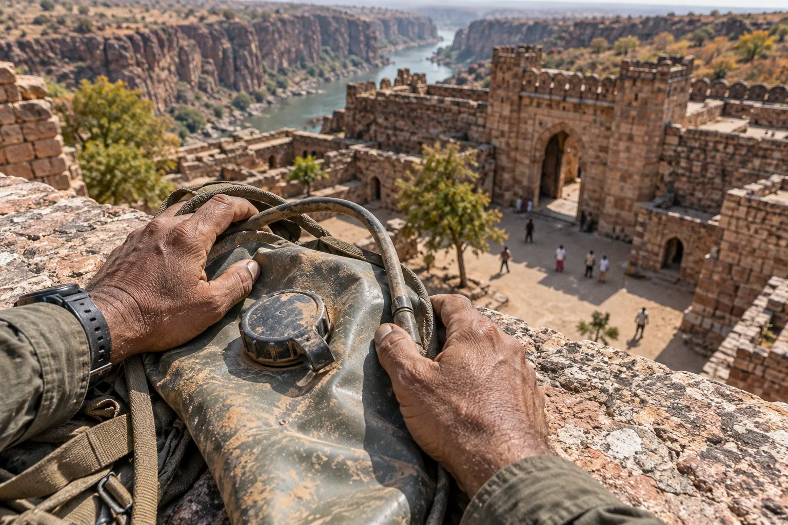
The direct route covers approximately 150–155 km and can take around three to three and a half hours of continuous driving, while the more rewarding Rayalaseema road trip route from Gandikota to Kurnool bends north through Belum Caves, Owk Reservoir, and Yaganti before reaching the Kurnool tourism belt, extending the journey to roughly 220 km.
That distinction matters because the longer route is not simply a slower version of the same drive. It crosses several different landscapes: the red quartzite gorge and fortified plateau at Gandikota, the limestone chambers beneath Belum, the broad waterline of the Owk Reservoir, and the sculpted rock setting of Yaganti Temple. We are not following a single scenic corridor so much as traversing a sequence of geological and cultural zones, each requiring a different pace and a little more attention to the map.
The direct road gets you to Kurnool; the scenic circuit explains the landscape between the two.
The dual path: choosing between the direct road and the scenic circuit
If your priority is arrival, the direct Gandikota to Kurnool road trip is the sensible choice. The road distance is approximately 150–155 km, with a continuous driving time of about three to three and a half hours. This is the route to take when Kurnool is an overnight base, when you have a train or onward connection, or when the heat has already made the exposed Gandikota plateau feel longer than it looked on the map.
The scenic circuit adds the principal regional landmarks and brings the total driving distance to around 220 km. The route uses state highways and National Highway 40 across much of the wider journey, but the experience is not that of a uniform, high-speed motorway. The inner sections between the smaller towns and attractions should be approached as regional roads: useful, navigable, and often quiet, but not designed for hurried sightseeing.
The first major decision is whether Belum Caves should be treated as a short stop or as the central event of the day. From Gandikota, Belum lies approximately 60–65 km to the north, requiring around one hour and fifteen minutes of driving in ordinary conditions. That makes it a natural first leg, especially if you leave Gandikota early enough to reach the caves close to their opening time.
From Belum, the route can continue towards Owk Reservoir, which is roughly 10 km away, and then branch into the longer approach to Yaganti Temple. Yaganti lies approximately 45 km from Belum Caves on the circuit leading towards Kurnool. In practical terms, this means the landscape keeps changing while the distances remain manageable; the difficulty is not one punishing transfer but the accumulation of stops, walking, heat, and return-to-road time.
Two ways to read the route
| Route choice | Approximate distance | Continuous driving | Best suited to | Main limitation |
|---|---|---|---|---|
| Direct Gandikota to Kurnool road | 150–155 km | 3–3.5 hours | Fast transfer, onward connections, short itineraries | Misses Belum, Owk, and Yaganti |
| Scenic Rayalaseema circuit | Around 220 km | Longer day with several stops | Geological sightseeing and regional exploration | Requires an early start and more daylight |
| Gandikota to Belum first | 60–65 km | About 1 hour 15 minutes | Beginning the circuit with the largest underground attraction | Cave visit is constrained by its 10:00 AM opening |
| Belum to Yaganti leg | About 45 km | Varies with road conditions and stops | Combining cave and temple landscapes | Leaves less time for unplanned detours |
The scenic route works best when you resist the temptation to measure it only in kilometres. Belum Caves has a fixed visiting window, while Gandikota and Owk Reservoir are more dependent on sunlight, visibility, and the amount of time you want to spend walking or looking across open terrain. A road trip that begins too late may technically include all the landmarks while giving none of them the right conditions.
From the Pennar Gorge to the limestone country
Gandikota establishes the visual vocabulary of the journey. The fort occupies a plateau beside the Pennar Gorge, where the exposed red quartzite gives the landscape its hard, fissured character. Here, the most useful way to navigate is by relationship: the fort complex sits above the gorge, and the principal viewpoints are oriented towards the incised river valley rather than towards a single formal entrance or central square.
Once we leave Gandikota and travel north towards Belum, the terrain begins to read differently. The journey is no longer organised around a canyon edge but around the limestone country beneath the road. Belum Caves is not a shallow rock shelter or a short cave walk. The system measures 3,229 metres in length, making it the second-longest cave system in the Indian subcontinent, and its deepest point, Patal Ganga, lies 120 feet below the entrance level.
That depth changes how we should plan the stop. At Gandikota, the eye moves horizontally across the gorge; at Belum, the route turns inward and downward. Corridors narrow, chambers open unexpectedly, and the sense of direction comes from the sequence of passages rather than from distant landmarks. The cave is therefore best approached as a substantial visit within the itinerary, not as a place to photograph at the entrance before rushing towards Kurnool.
Belum Caves is open daily from 10:00 AM to 5:30 PM. Standard entry is ₹50 for adults and ₹35 for children. These details are practical anchors for the day: if you leave Gandikota after a leisurely morning, you may still reach the caves within opening hours, but you will have less flexibility for Owk Reservoir and Yaganti later.
How to position Belum in the itinerary
The most coherent sequence is:
1. Start from Gandikota early. The 60–65 km transfer to Belum is short enough to complete without turning the morning into a race, but the cave’s opening time gives you a fixed point around which to build the day.
2. Allow the cave to occupy the middle of the morning. Its 3,229-metre extent and 120-foot descent make a hurried visit a poor use of the detour.
3. Use Owk Reservoir as the open-air transition. After the enclosed limestone passages, the reservoir restores the long sightlines that defined Gandikota.
4. Continue to Yaganti only if daylight and energy remain. The temple is approximately 45 km from Belum, and its setting rewards slower observation rather than a rushed arrival.
5. Approach Kurnool as the final regional base. If the circuit has already included all three detours, the last leg should be treated as a transfer rather than another sightseeing segment.
The important spatial contrast is between what is visible from the road and what is hidden beneath it. Gandikota announces its geology through the gorge; Belum conceals its scale until you descend. Together, they make the first half of the route more varied than a standard fort-to-city drive.
Belum is not a roadside interruption on this circuit; it is the point where the journey changes direction from looking across the land to moving through it.
Descending into the 3,229-metre Belum Caves system
For travellers planning the scenic stops between Gandikota and Kurnool, Belum is the attraction that most strongly determines the order of the day. The cave’s length is significant, but the more useful fact for route planning is its vertical relationship to the surface: Patal Ganga is 120 feet below the entrance level. You are not simply following a lit corridor beneath a visitor centre; you are entering a layered subterranean environment in which stairs, passages, chambers, and changes in enclosure shape the experience.
The entrance area is therefore only the beginning of the visit. Once below ground, the visual markers become architectural rather than geographical. A broad chamber reads differently from a constricted passage, and a junction in the cave requires the same attention to direction that a fork in a rural road does. Keep the route mentally organised by the way you entered and by the sequence of spaces you pass through, rather than assuming every corridor will look familiar on the return.
Belum’s scale also affects clothing and timing. A visit involves walking below the surface and moving through an environment distinct from the exposed heat of the Rayalaseema plateau. Comfortable footwear is more useful than anything designed merely for photographs, and a small amount of water is sensible for the wider road day, even though the cave itself is not the place to carry unnecessary luggage.
The fixed hours, 10:00 AM to 5:30 PM, should be read alongside the rest of the circuit. If Belum is your first major stop, you can continue towards Owk Reservoir with a reasonable portion of daylight still available. If you place it late in the itinerary, the 5:30 PM closing time leaves little room for delays on the approach road, extended stops at the reservoir, or the 45 km transfer towards Yaganti.
The cave is also where many itineraries become overconfident. Maps may make Gandikota, Belum, Owk, Yaganti, and Kurnool appear close enough to connect casually, but the route is not a collection of attractions inside one compact park. Each stop has an approach, a parking or walking transition, and a different visual rhythm. The scenic circuit is best understood as a full travel day or a carefully divided two-day route, not as a list to be completed at any cost.
Owk Reservoir: a change from enclosure to horizon
Owk Reservoir lies approximately 10 km from Belum Caves and roughly 70 km from Gandikota. It was created by raising an earthen dam across the Paleru River, with the dam reaching a height of 220 feet and the water area extending beyond 1,000 acres. These dimensions are not just engineering details; they explain why the reservoir changes the character of the road trip so quickly.
At Gandikota, the land is cut into a narrow gorge. At Belum, it is hollowed into a cave. At Owk, the same regional journey opens into a broad water landscape whose edges are read through distance, embankment, and sky. The reservoir is consequently most valuable as a spatial counterpoint to the cave: after moving down through limestone, we return to an expansive setting where the horizon is once again the principal landmark.
The approach should be taken without expecting a polished waterfront promenade at every point. This is a regional excursion landscape, not an urban leisure lake, and the experience depends on where the road brings you and how much of the surrounding terrain is visible at that moment. The reservoir’s broad scale can be appreciated even during a relatively short stop, but it rewards travellers who pause long enough to understand the relationship between the earthen dam, the water spread, and the surrounding dry terrain.
For navigation, the reservoir works best as a deliberate waypoint between Belum and the rest of the circuit. It prevents the journey from becoming a sequence of enclosed monuments and gives you a place to reset before continuing. If the day is hot, this is also where the practical cost of an overfull itinerary becomes clear: a stop that looks brief on paper can become tiring when combined with walking at Gandikota, descending at Belum, and repeated vehicle transfers.
What to observe at the reservoir
Rather than searching for a single viewpoint, read the landscape through three intersecting elements:
- The dam structure: the 220-foot earthen dam is the human-made line that holds the water against the surrounding terrain.
- The water spread: extending over more than 1,000 acres, it creates a long horizontal field that contrasts with the vertical descent of Belum.
- The dry plateau around it: the reservoir is not isolated from Rayalaseema’s geology; the surrounding land remains part of the same broad regional setting, even as water changes the immediate view.
The best time to stop depends on the larger route. Midday light can flatten a water surface and make exposed viewpoints uncomfortable, while late afternoon gives the embankment and surrounding terrain more definition. Yet late afternoon is also when you need to protect the road time remaining towards Yaganti or Kurnool. The reservoir is therefore an excellent place to pause, but not a reason to ignore the clock.
Yaganti Temple: where architecture and geology meet
Yaganti Temple, formally Sri Yaganti Uma Maheswara Temple, lies approximately 45 km from Belum Caves along the route towards Kurnool. Its importance within the circuit is not only religious. The temple is part of the same journey through stone, but it presents that stone through built form, carved surfaces, enclosed courtyards, and the relationship between architecture and the surrounding rock.
This is where the route’s cultural geography becomes especially legible. At Gandikota, the fort follows the defensive edge of the plateau. At Belum, the visitor route follows a natural subterranean system. At Yaganti, the sacred complex gathers movement into an architectural sequence: approach, threshold, enclosure, shrine, and the rock formations that flank the temple setting.
You do not need specialist architectural vocabulary to read the site. A mandapa, for example, is simply a pillared hall that mediates between the outer approach and the more restricted shrine area. A courtyard is an open internal space that lets the temple breathe within its enclosing walls. These elements matter on the ground because they tell us how the site expects to be traversed: not as one object viewed from a distance, but as a progression through changing degrees of openness and focus.
After the reservoir, Yaganti also brings the journey back from infrastructure and landscape scale to human scale. The road has taken us through a gorge, under limestone, and along a water-storage system; the temple concentrates attention again on thresholds, stone surfaces, and the way a sacred place is positioned within its geological surroundings.
Plan the stop with the same courtesy you would bring to any active religious site. Dress and behaviour should suit the setting, and photography should follow the rules in force locally rather than assumed permissions. Since exact timings and local arrangements can change, the route should not depend on arriving at the last possible moment. The temple is approximately 45 km from Belum, but the meaningful measure is how much daylight and attention remain after the earlier stops.
Driving directions, road conditions, and the shape of the day
The driving directions from Gandikota to Kurnool are straightforward only if we separate the direct transfer from the sightseeing circuit. The direct route is approximately 150–155 km. The scenic route through Belum Caves and Yaganti is around 220 km, with Owk Reservoir adding a short additional movement near Belum. Confusing these distances is one of the easiest ways to build an itinerary that looks reasonable on a screen and becomes exhausting on the ground.
The road network relies predominantly on state highways and National Highway 40, but that does not mean every section should be treated alike. The highway portions help connect the regional towns and larger route segments; the approaches to individual attractions may feel slower because they intersect smaller settlements, local traffic, and access roads that are not designed for continuous high-speed travel. Current toll charges on the state highway sections between Banaganapalli and Kurnool are not established here, so keep a payment method available without building an exact toll budget around an unverified figure.
Private cab availability and hourly rental rates between Gandikota village and Kurnool city can also vary. For an independent explorer, the useful question is not merely whether a car can be hired, but whether the driver understands that the vehicle will be making multiple attraction stops rather than travelling directly between two cities. Confirm the intended circuit before departure, especially if Belum and Yaganti are essential rather than optional.
A practical day plan might look like this:
1. Gandikota departure: leave with enough margin to reach Belum after its 10:00 AM opening, rather than arriving before opening and waiting through the hottest part of the morning.
2. Belum Caves: treat the cave as the principal stop, allowing time for its descending passages and underground scale.
3. Owk Reservoir: continue the approximately 10 km transfer for a shorter open-air pause and a change in landscape.
4. Yaganti Temple: take the approximately 45 km leg only if the remaining daylight and energy make a respectful visit possible.
5. Kurnool: finish the circuit in the city, or divide the journey earlier if you prefer not to turn the final road section into a night transfer.
This order is not the only possible arrangement, but it follows the geography cleanly. It begins with the gorge at Gandikota, moves north to the caves, shifts to the reservoir, and then turns towards the temple and Kurnool. Each stop prepares a visual contrast with the next.
When the direct route is the better decision
There is no virtue in choosing the scenic circuit when the conditions do not support it. Take the direct road when:
- you have a firm onward departure from Kurnool;
- you are travelling with people who do not want a full day of walking and transfers;
- you reach Gandikota too late to make Belum’s opening hours useful;
- the weather makes the exposed reservoir and temple approaches uncomfortable;
- you would arrive at Yaganti near closing or after the practical daylight window.
The direct journey can still be part of a larger Rayalaseema road trip. Belum, Owk, and Yaganti do not disappear because they are omitted on one transfer; they simply belong on a day when the route can be given the time it requires.
Building the wider Rayalaseema circuit
For travellers interested in the best road trip circuits in Rayalaseema, Gandikota to Kurnool is valuable because it connects several kinds of landmark without pretending they are interchangeable. Belum Caves is a subterranean geological destination. Owk Reservoir is a large-scale water and landscape intervention. Yaganti is a temple complex whose architecture is embedded in a rocky setting. Kurnool then provides the broader regional anchor from which other excursions can be considered.
The route can also be understood as part of a wider Kadapa–Kurnool travel pattern, with nearby geological and cultural sites joined by state highways rather than by one curated tourist road. That is why route planning should remain flexible. A map may indicate a short distance, but the day’s real capacity depends on opening hours, walking, meal stops, heat, and whether you want to observe a site or merely record that you passed through it.
Mylavaram Dam and the wider Owk reservoir landscapes can be considered as separate excursions when the schedule allows, while Belum is best protected as a dedicated stop because its scale cannot be compressed into a few minutes. Travellers extending towards the Kurnool tourism belt may also choose to split the circuit, using one day for Gandikota and Belum and another for the reservoir, Yaganti, and Kurnool. That arrangement reduces the pressure created by the 220 km scenic loop and gives the late-day sites better light.
The historical timeline of the region is equally layered. Gandikota’s initial sand fort construction is associated with Kapa Raja in 1123 CE. The original earth dams at Owk Reservoir were constructed in 1946, while Belum Caves officially opened to the public through Andhra Pradesh Tourism in 2002. These dates should not be read as a single continuous story, because the sites belong to different historical and infrastructural moments. Their value on the road lies precisely in that overlap: medieval fortification, modern water engineering, and recent public access to an ancient cave system occupy one navigable landscape.
The route is most rewarding when we stop treating its landmarks as isolated attractions and read them as different ways of occupying the same terrain.
Timing the road trip for useful light
Light is not a decorative final consideration on this circuit; it determines what the landscape reveals. Gandikota’s gorge is best approached when the sun gives texture to the quartzite and the cliff faces rather than reducing them to a bright, flat surface. Owk Reservoir needs enough daylight to distinguish water from the dry land flanking it. Yaganti benefits from arriving with time to see the relationship between the temple’s built forms and the rock around them.
Belum follows a different clock because its principal spaces are underground and its visiting hours are fixed at 10:00 AM to 5:30 PM. This makes the cave the scheduling hinge, while Gandikota and Owk are more responsive to the quality of daylight. If you are travelling in one day, begin early from Gandikota, place Belum first, and keep the latter part of the itinerary adjustable. If the morning has slipped, choose either Owk or Yaganti rather than reducing both to hurried roadside photographs.
The final practical tip is simple: plan the scenic circuit by light, not merely by distance. Leave Gandikota early enough to reach Belum during its open hours, use the reservoir as the broad daylight landscape between cave and temple, and reserve the softer later light for the gorge or the architectural setting at Yaganti whenever the route permits. Kurnool is the destination on the map, but the journey earns its length through the sequence of spaces between the two cities.