Yaganti Temple to Gandikota: route guide and travel time
The direct Yaganti Temple to Gandikota route travel time is usually around 2 to 2.5 hours, covering approximately 88 kilometres by road.
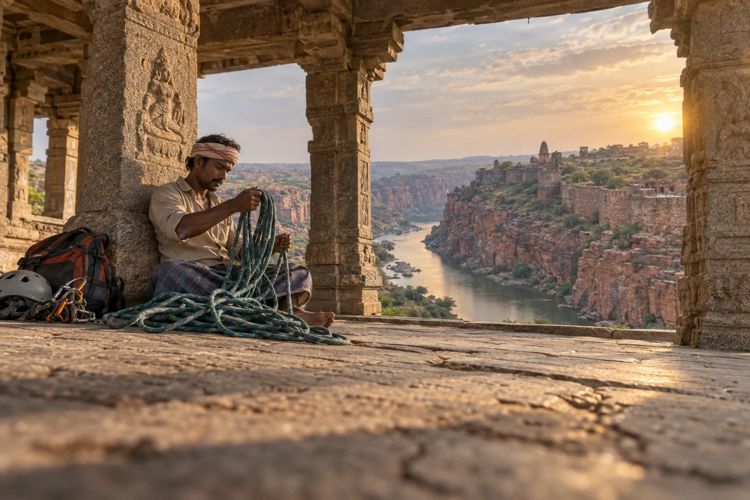
On the map, this looks like a short transfer across Rayalaseema; in practice, it is a rural journey shaped by local roads, temple timings, village traffic, and the final approach toward the Pennar River gorge.
The most useful way to plan it is not as an isolated drive, but as part of a wider circuit. Belum Caves lies roughly 44–45 kilometres from Yaganti and a further 62–65 kilometres from Gandikota, making it a natural geological and cultural stop between the temple and the canyon. With the cave visit added, the total driving distance becomes approximately 106–110 kilometres, before accounting for small diversions, food stops, or local sightseeing.
Navigating the 88-kilometre direct route
Yaganti Temple and Gandikota belong to the same broad Rayalaseema travel landscape, but they offer very different spatial experiences. Yaganti is approached as a sacred architectural site enclosed by rocky hills, while Gandikota opens outward across the Pennar gorge, where the fortifications occupy the edge of a long red-quartzite canyon.
The direct road journey connects these two environments through the interior of Andhra Pradesh rather than along a single, fast expressway. You will be moving through rural stretches and local towns, with the route commonly understood in relation to the Banaganapalle, Owk, and Jammalamadugu side of the region. The exact experience of the drive can change with road maintenance, local diversions, seasonal traffic, and the condition of smaller connecting roads, so navigation should be checked shortly before departure.
The distance itself is manageable. The timing requires more attention.
A navigation app may display a clean two-hour estimate, but that figure assumes a reasonably uninterrupted drive. It does not necessarily account for leaving Yaganti after a temple visit, slowing through settlements, stopping for fuel or food, or finding the correct approach toward Gandikota Fort once you are near Jammalamadugu. If you are travelling independently, a practical planning window is:
- About two hours for a straightforward drive with minimal stops.
- Two to 2.5 hours for a more comfortable transfer with ordinary rural delays.
- Longer than 2.5 hours if you add sightseeing, depart late in the day, or encounter roadworks and local diversions.
Gandikota is located in the Kadapa, or YSR, district, approximately 15 kilometres from Jammalamadugu, and this final relationship matters when you are setting your route. Gandikota is not simply a viewpoint beside a major highway; the fort and canyon sit beyond the main urban reference points, so the last stage of the journey should not be treated as an afterthought.
The 88-kilometre distance is straightforward; the real planning question is whether you want to arrive at Gandikota with enough daylight left to understand the gorge.
What the direct route is good for
The direct journey works best when Gandikota is your main destination and you have already seen Yaganti at a comfortable pace. It is also useful for travellers staying near the fort, camping in the Gandikota area, or trying to reach the Pennar gorge before the strongest afternoon light begins to soften.
This option keeps the day geographically simple:
1. Explore Yaganti Temple and its immediate rocky setting.
2. Leave enough time for the rural transfer rather than departing at the last possible moment.
3. Arrive near Gandikota with daylight for the fort, gorge edge, and surrounding landscape.
4. Reserve the later part of the day for the canyon rather than trying to compress every stop into the drive itself.
The temptation is to treat Yaganti as a quick morning photograph and Gandikota as an evening viewpoint. That can work, but it leaves little margin if the temple visit takes longer than expected or if the road journey is slower than the map estimate. The more reliable approach is to decide in advance whether your priority is temple architecture, the Belum Caves detour, or sunset at the Pennar gorge.
The Belum Caves variation: a longer but richer circuit
Belum Caves gives the journey a geological middle chapter. From Yaganti, the caves are approximately 44–45 kilometres away, and the onward drive from Belum Caves to Gandikota is roughly 62–65 kilometres, taking around 1.5 hours under ordinary conditions.
This produces a total driving distance of approximately 106–110 kilometres for the Yaganti–Belum–Gandikota circuit. The added distance is not excessive, but the cave visit changes the rhythm of the day because Belum requires its own dedicated time. A typical visit takes around two hours, and the listed visiting hours are 10 AM to 5 PM.
That opening window should determine the order of your itinerary. If you begin at Yaganti very early, you may reach Belum before it opens and have to wait. If you leave Yaganti too late, the cave visit can push your arrival at Gandikota into the darker part of the evening. Neither problem is difficult to solve, but both are easy to create by planning only from distances rather than from operating hours.
| Route option | Approximate driving distance | Typical driving time | Time required beyond driving | Best suited to |
|---|---|---|---|---|
| Yaganti to Gandikota direct | About 88 km | Around 2–2.5 hours | Temple visit and canyon sightseeing | Travellers prioritising Gandikota or a simpler transfer |
| Yaganti to Belum Caves to Gandikota | About 106–110 km | Yaganti–Belum plus about 1.5 hours onward | Around 2 hours at Belum Caves | Travellers building a geological and heritage circuit |
| Yaganti to Belum Caves and back toward the Gandikota area | Varies with the final route | Depends on local road conditions and stops | Longer, more flexible day | Travellers with overnight accommodation and no sunset deadline |
The Belum variation is particularly strong for travellers who want the landscape to explain itself. Yaganti presents rock as a sacred and architectural setting; Belum takes you below the surface; Gandikota then returns you to the exposed edge of the Pennar valley. These are not identical attractions joined merely because they appear on the same map. Together, they create a sequence of enclosed, subterranean, and open geological spaces.
How long should you allow?
For the direct route, a half-day transfer can be sufficient if Yaganti is a focused stop and Gandikota is your destination.
For the Belum Caves circuit, treat the day as a full excursion rather than a quick detour. The two-hour cave visit sits between two driving legs, and the practical time also includes finding the entrance, moving through the site at a comfortable pace, and leaving enough daylight for Gandikota.
A useful distinction is:
- Direct route: efficient, but less forgiving.
- Belum route: more complete, but dependent on the caves’ 10 AM–5 PM operating window.
- Overnight circuit: best when you want to see both Belum and Gandikota without sacrificing the canyon light.
Building a Yaganti sightseeing itinerary before the drive
Yaganti should not be planned only as a departure point. The temple occupies a setting where built form, rock, and movement through the site are closely connected, and the order in which you explore it affects how much of that relationship you notice.
Begin with the principal temple area, then allow yourself time to look outward toward the surrounding rock formations rather than remaining focused only on the entrance and inner spaces. The site is best understood through its transitions: from approach road to temple precinct, from open ground to enclosed architecture, and from constructed surfaces to the irregular hill forms flanking the complex.
You do not need an elaborate schedule, but you do need a departure decision. Ask yourself whether Gandikota is an evening destination or simply the next overnight location. If the canyon is the reason for the journey, do not allow the Yaganti visit to expand until the drive becomes a race against the light.
A balanced morning might follow this pattern:
1. Reach Yaganti with enough time to visit the temple without immediately watching the clock.
2. Walk through the main precinct and observe how the temple sits against the rocky terrain.
3. Keep the final part of the visit for orientation: identify your road exit, check the next navigation point, and leave before the route becomes compressed.
4. Continue directly to Gandikota, or take the Belum Caves route only if its opening hours fit the day.
5. Reserve the final daylight for the Pennar gorge and the fort-side landscape.
The point is not to rush through Yaganti. It is to give the journey a shape in which each stop has its own purpose.
Direct route or Belum Caves circuit?
The choice depends less on the nominal distance than on what you want the day to accomplish.
If your main aim is to reach Gandikota for the canyon views, the direct route is the cleaner decision. The 88-kilometre drive is short enough to connect the two sites without turning the day into a logistical exercise, and you can spend the saved time exploring the fort area or finding your accommodation.
If your interest lies in Rayalaseema’s geological character, Belum Caves is the stronger addition. The caves introduce a subterranean scale that the exposed Pennar gorge cannot provide, while Yaganti gives the route a cultural and architectural anchor. The resulting itinerary is longer, but it is also more coherent than a collection of unrelated roadside stops.
Choose the Belum Caves circuit when:
- You can fit the cave visit between its 10 AM and 5 PM operating hours.
- You are comfortable reaching Gandikota later than you would on the direct route.
- You have arranged an overnight stay or do not need to continue far beyond the fort.
- Your priority is a broader landscape itinerary rather than the earliest possible arrival at the canyon.
Choose the direct route when:
- Gandikota sunset or late-afternoon light is the central objective.
- You are travelling with limited daylight.
- You want more time at the fort and Pennar gorge.
- You are uncertain about rural road delays and would rather preserve a margin.
The mistake is not choosing one route over the other. The mistake is trying to do both at full length without acknowledging that Belum Caves is a two-hour visit, not a ten-minute roadside pause.
Road conditions and the practical realities of rural transit
Current conditions on the rural stretches between Banaganapalle, Owk, and Jammalamadugu can change, and a static route description cannot guarantee the surface quality on the day you travel. This is one of those journeys where the map provides the skeleton, but local conditions determine the pace.
You may encounter sections where progress is slower than the distance suggests, particularly around settlements, junctions, or smaller roads leading away from the principal route. The most sensible preparation is simple:
- Check the route on the morning of departure rather than relying only on a saved estimate.
- Download or prepare offline navigation before leaving areas with stronger mobile coverage.
- Keep fuel and drinking water available for the rural sections.
- Avoid treating the final kilometres toward Gandikota as an effortless highway approach.
- Build a time margin if you are travelling for sunset, a fixed check-in, or a cave entry window.
- Confirm the day’s route again after leaving Yaganti, especially if you are adding Belum Caves.
Public transport requires even more caution. There is no basis for assuming a high-frequency, direct, non-stop bus connection between Yaganti Temple and Gandikota Fort. Independent travellers should not construct a tight itinerary around an unverified direct service. A private car, hired vehicle, or pre-arranged driver gives you far more control over the sequence of Yaganti, Belum, and Gandikota, particularly because these sites are separated by rural roads rather than a single tourist shuttle corridor.
For those travelling without a private vehicle, the practical approach is to break the journey through larger local transport points and confirm onward connections locally. That can work, but it is a different kind of day: less about following a fixed sightseeing circuit and more about allowing the route to unfold around available transport.
Reaching Gandikota and reading the final approach
Gandikota’s location near Jammalamadugu is useful for orientation, but the fort should be understood as a landscape destination rather than a town-centre attraction. Once you are in the broader area, the route becomes about approaching the canyon edge and the historic enclosure that follows its contours.
The first-time mistake is to focus only on reaching the fort gate. The more rewarding arrival is slower and more observant. Notice how the terrain begins to open, how the road leaves behind the more settled spaces, and how the red rock becomes a directional marker in its own right. Gandikota’s identity is inseparable from the way the fort occupies the gorge: the defensive walls, the canyon edge, and the Pennar below are not separate attractions but intersecting parts of one spatial system.
If you arrive with limited light, prioritise orientation before detail. Locate the main viewpoint area, understand the direction of the gorge, and then decide whether you have time for the fort’s architectural remains. Trying to photograph everything immediately can make the site feel fragmented. A short pause to understand the relationship between the walls and the river will make the later walk more meaningful.
This is also why the direct journey can be preferable even when Belum Caves is technically on the broader circuit. Gandikota rewards unhurried looking. The canyon is not an attraction that reveals its scale in a single close-up; it depends on distance, alignment, and the way the fort wall runs beside the drop.
Timing the journey for the best light
The best time to visit Yaganti and Gandikota is not governed by one universal hour. It depends on whether you want temple detail, comfortable driving, or the changing light over the Pennar gorge.
Yaganti is easier to absorb earlier in the day, when you can move through the temple precinct before the journey becomes a race toward the next stop. Gandikota is more visually rewarding when the sun is lower and the gorge begins to show stronger relief, but that preference creates a timing problem: the direct drive may take two to 2.5 hours, and the Belum circuit adds a fixed two-hour cave visit.
For a direct Yaganti-to-Gandikota day, aim to leave Yaganti with a clear margin before the late afternoon. That gives you time for ordinary road variation and allows the final approach to happen in daylight.
For a Belum itinerary, work backwards from the caves’ 10 AM–5 PM hours and from the time you want to reach Gandikota. The cave visit should not be squeezed between an overly long temple stop and a sunset deadline. If the canyon light matters most, keep Yaganti focused, arrive at Belum within its operating window, and accept that the later Gandikota visit may be shorter. If the full sequence matters more than sunset, allow the day to extend and arrange accommodation near Gandikota.
A simple planning table can help:
| Priority | Recommended structure |
|---|---|
| Gandikota sunset | Yaganti in the morning, direct drive, canyon first on arrival |
| Full geological circuit | Yaganti, Belum Caves during 10 AM–5 PM, then Gandikota |
| Detailed temple visit | Give Yaganti a generous morning, take the direct route, accept a later Gandikota arrival |
| Flexible overnight road trip | Include Belum Caves and use the evening for a slower arrival near the fort |
The light changes quickly across the gorge, but the larger advantage of an early start is not photographic. It is logistical. You retain options. A delayed departure removes them one by one.
A workable one-day and two-day plan
One-day direct itinerary
A direct one-day plan is the most disciplined version of the journey. Visit Yaganti in the morning, leave with the 88-kilometre transfer ahead of you, and reach Gandikota in time to orient yourself before the strongest evening light begins to fade.
This plan is best for travellers who have already decided that Gandikota is the principal destination. It also leaves room for a more considered exploration of the fort and the gorge rather than turning both sites into hurried photo stops.
The essential rule is to protect the driving window. Once you leave Yaganti, avoid adding an improvised detour unless you have already accepted that Gandikota will become a late arrival.
One-day Yaganti–Belum–Gandikota itinerary
This version is possible, but it needs a firmer timetable. The route covers approximately 106–110 kilometres of driving, and Belum Caves itself usually requires around two hours. Since the caves operate from 10 AM to 5 PM, the day should be arranged around that window rather than added casually after the temple visit.
This is the right plan for travellers who see the route as a connected landscape journey. It is less suitable if a particular sunset, campsite arrival, or fixed evening appointment at Gandikota is non-negotiable.
Two-day circuit
The two-day version gives each place more room. You can explore Yaganti without treating it as a departure platform, visit Belum Caves during its operating hours, and approach Gandikota without having to compress the fort and gorge into the final minutes of daylight.
For independent travellers, this is usually the most forgiving structure. It reduces the consequences of rural road delays and gives you a better chance of experiencing Gandikota as a place rather than as the last coordinate in a long itinerary.
The route as a Rayalaseema landscape
The journey from Yaganti to Gandikota works because the attractions are connected by more than distance. They sit within a region where temple architecture, exposed rock, underground formations, reservoirs, dry agricultural landscapes, and historic routes overlap.
Belum Caves makes that connection particularly visible. The cave visit is not merely an additional attraction for a list; it changes the scale at which you read the region. At Yaganti, rock frames the sacred precinct. At Belum, rock becomes the space through which you move. At Gandikota, the same broad geological character opens into a vast gorge, with the fort occupying the defensible edge.
That sequence explains why the Yaganti temple day trip from Gandikota—or the reverse journey—can feel more substantial than the road distance suggests. You are not simply crossing 88 kilometres. You are traversing a series of different relationships between people, stone, water, and movement.
Final planning advice
If you want the cleanest journey, drive directly from Yaganti to Gandikota and allow two to 2.5 hours rather than relying on the shortest map estimate. If you want the fullest regional route, add Belum Caves, budget around two hours for the visit, and plan around its 10 AM–5 PM operating hours. The total circuit will be approximately 106–110 kilometres, with the Belum-to-Gandikota leg taking about 1.5 hours.
Above all, decide what deserves the best light before you begin: the temple precinct, the caves, or the Pennar gorge. Once that priority is clear, the route becomes easy to shape. Leave Yaganti with enough margin, treat rural road timing honestly, and reach Gandikota before darkness removes the spatial relationships that make the journey worth taking.